Climate scientists explain: What’s the worst that could happen?
Climate change conversations often centre on most likely outcomes – a few degrees of warming, rising seas, more frequent heatwaves and storms. But what about the worst that could happen?
A new study led by scientists at the University of Reading, National Centre for Atmospheric Science, and National Oceanography Centre presents a suite of high-impact, low-likelihood climate scenarios for the UK. This offers decision-makers some tools for testing the resilience of existing planning frameworks against extreme outcomes.
Supporting risk assessment for climate extremes
In 2021, the UK Climate Change Committee introduced 10 principles for good adaptation – recommending that the UK “adapt to 2°C and assess the risks for 4°C,” and prepare for “unpredictable extremes.”
Several UK decision-making agencies have to consider “credible maximum scenarios” for steering investments and development, and need the capability to anticipate the consequences of climate extremes and high-risk impacts.
The scenarios provided by the NCAS-Reading research team are directly relevant to “preparing for the worst”, but they don’t claim to be predictions. Instead, the climate scientists describe them as physically plausible outcomes that need seriously thinking about – severe enough that ignoring them could leave infrastructure, communities and economies dangerously unprepared.
Understanding “what’s the worst that could happen?” is not about fear-mongering, it’s about being prepared. In an era of accelerating climate impacts, planning with both probability and possibility in mind may prove one of the most important investments for future resilience.
– Professor Ed Hawkins, climate scientist at the National Centre for Atmospheric Science and University of Reading.
The team developed two categories of scenarios.
The first set includes long-term trajectories to 2100, describing the drivers of climate impacts that are outside or at the edge of the range of “conventional” climate scenarios. The second set includes shorter-term monthly and seasonal climate extremes, focusing on temperature, rainfall and windspeed.
It’s important to know that both sets describe what would be driving the high-impact low-likelihood climate scenarios, not the actual outcomes or impacts.
“Current climate projections tend to focus on the most likely outcomes tied to greenhouse gas emission pathways. This study deliberately explores the edges of physical plausibility to help government planners understand and stress-test against outcomes that, while unlikely, could have huge consequences if realised,” says Professor Ed Hawkins, climate scientist at the National Centre for Atmospheric Science and University of Reading.
Plausible high-impact low-likelihood climate scenarios to 2100
Here we have six scenarios for long-term trajectories to 2100, from enhanced global warming and volcanic eruptions, to sea ice loss and ocean circulation collapse.
1. Enhanced global warming scenario
If global temperature increases well above 4°C due to very high greenhouse gas emissions, or stronger carbon cycle feedbacks, or high climate sensitivity.
2. Rapidly reduced aerosol forcing scenario
With much lower aerosol emissions than usually anticipated there could be an increase in warming across the UK by up to 0.75°C.
3. Tropical volcanic eruption scenario
Following a major volcanic eruption there could be a temporary cooling, by up to 2.5°C.
4. Stronger Arctic amplification scenario
A strong increase in Arctic warming could lead to loss of Arctic Ocean sea ice and circulation changes, which then increase the frequency of cold dry periods in winter. The jet stream in winter would also become weakened and shift to the south.
5. Ocean circulation change scenario
Changes in circulation in the North Atlantic Ocean could lead to cooling across the UK, of up to 6°C.
6. Enhanced sea level rise scenario
Rapid deglaciation in Antarctica could lead to an increase in sea level around the UK of up to 2.2 m above current levels.
Plausible high-impact low-likelihood monthly or seasonal climate extremes
Here we have five scenarios for individual extreme months or seasons – hot, cold, wet, dry and windy. It is plausible that combinations of these could occur in the same month or season, or that one extreme could flip to another from one month to the next, or that extremes could persist for several months.
1. Hot
If average monthly temperatures were between 4 and 6°C above the mean, winter could be wet and windy – with a strong jet stream and cyclonic conditions. Summer could be dry and calm, with a weak, meandering jet stream, plus blocking and anticyclonic conditions.
2. Cold
If average monthly temperatures were between 4 and 7°C below the mean, winter could be dry and calm, with persistent anticyclonic conditions over Scandinavia, a weak jet stream, frequent sudden stratospheric warmings and cold air outbreaks. Summer could be wet and windy, with a strong jet stream to the south, frequent windstorms and strongly cyclonic.
3. Wet
Average monthly rainfall between 2.5 and 3 times the mean could lead to mild and windy conditions in winter, and cool and windy conditions in summer. The strongly cyclonic conditions could also be accompanied by a strong jet stream to the south of its average position.
4. Dry
Average rainfall that was 10% of the mean, could bring about a cold and calm winter, and a hot and calm summer, alongside strongly anticyclonic conditions, with a weak and meandering jet stream to the north.
5. Windy
If average windspeeds were 60%–80% higher than the average, winters might be mild and wet, and summers could be cool and wet. A strong jet stream could feature alongside strongly cyclonic conditions.
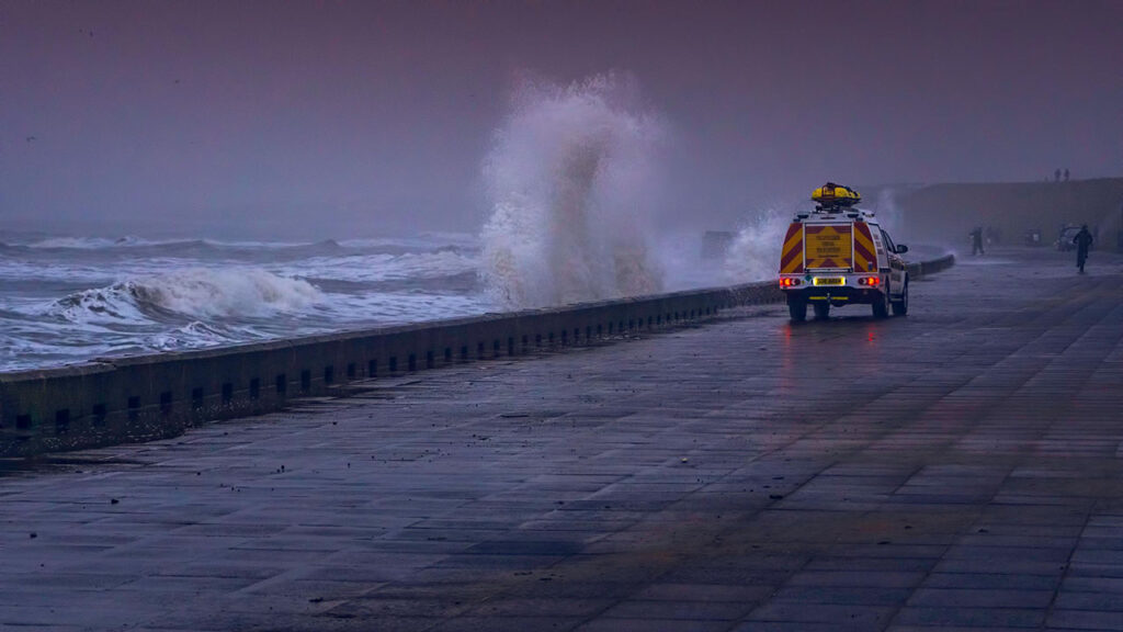
Most national and regional planning currently relies on central climate projections that might underestimate the severity or speed of change, especially for rare events. Without explicit consideration of worst plausible outcomes, infrastructure – from flood defences to energy grids – could fail under stressors beyond their design criteria.
– Professor Ed Hawkins, climate scientist at the National Centre for Atmospheric Science and University of Reading.