Studying clouds over Greenland’s melting ice sheet with a Helikite, Dr Heather Guy explains
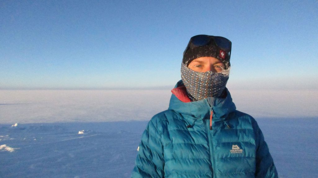
A Helikite has been used for the first time to observe clouds and aerosol particles over central Greenland’s ice sheet. We spoke to Dr Heather Guy, a researcher at the National Centre for Atmospheric Science based at the University of Leeds, about the scientific study.
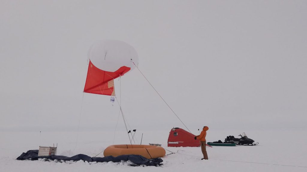
Heather travelled to Greenland’s Summit Station for four weeks to trial the use of the Helikite – a tethered helium-filled balloon fitted with scientific sensors, and a kite tail to provide positioning, stability, and lift.
Ice melt and rising sea levels – why are scientists studying clouds above Greenland’s ice sheet?
The Greenland ice sheet is seven times the area of the UK, and stores a large amount of the Earth’s frozen water. At current rates of melting, it contributes almost 1mm to sea level per year, and accounts for around a quarter of total sea level rise.
Rising sea levels are one of the most severe effects of climate change, threatening coastal areas around the world, and putting millions of people at risk. Eastern England is known to be particularly vulnerable to rising sea levels.
Clouds, particularly their abundance and water content, have a huge influence on ice sheet melt in Greenland.
How do aerosol emissions affect clouds in Greenland?
Researchers used a Helikite to measure aerosol particles – known to impact clouds – up to 1km above ground level at the apex of the Greenland ice sheet.
Aerosols are fine particles floating in the atmosphere, they can be solid or liquid, and can come from human and natural sources.
Aerosols can have a profound effect on the Earth’s surface by reflecting sunlight, trapping radiation, and changing the properties of clouds – impacting their lifetime and water content. Scientists expect aerosol levels will change in the coming decades, due to different sources and policies on emissions.
Understanding the types and amounts of aerosols up at cloud height, and how they differ from down at the ground, is a vital step towards understanding how changes in atmospheric aerosols may impact cloud properties and Greenland ice sheet melt in the future.

How did scientists use a Helikite to observe clouds over Greenland?
Measuring aerosol particles at cloud height in polar regions is challenging because it requires a stable measurement platform at 500m -1000m above ground level, which can also withstand icy conditions.
This rules out the use of drones, and favours the use of a Helikite.
The atmospheric research team launched scientific sensors attached to the Helikite skywards from the Greenland Summit Station, the only high altitude, high latitude, inland, year-round observing station in the Arctic.
Heather explains: “This was the first time the Helikite has been used at the summit, and potentially the first time the Helikite has been tested in such low ambient air surface pressures.”
Heather describes how the tethered measurement balloon was deployed: “The Helikite was used to lift a battery powered instrument package consisting of a Portable Optical Particle Spectrometer (POPS) and a Windsond for measuring ambient air pressure, temperature, and relative humidity.
“The first test flights were successful, and on the third day the Helikite reached a height of 678m above ground level and sampled multiple distinct vertical aerosol layers,” explains Heather.
The Helikite was used nine times over six sampling days, and on three of those days the target sampling altitude of 500m above ground level was exceeded – with the highest flight reaching 832m above ground level, 4,032m above sea level.
In future, how will scientists measure aerosol particles in Arctic air?
This proof-of-concept Helikite campaign is motivating future scientific studies over central Greenland to gain better insights into the vertical distribution of aerosol particles, and their relationship with cloud properties.
Now that researchers have shown that they can collect measurements in this way, they want to scope out a project that uses the FAAM Airborne Laboratory research aircraft, combined with Helikite measurements, and surface measurements.
Understanding the processes which affect the Greenland ice sheet melt, and how they might change in the future, are important for correctly projecting the trajectory of sea-level rise. This has crucial implications for the UK, particularly eastern England, which is at risk from coastal flooding due to rising sea levels.
