Scientists survey Scandinavian skies to profile clouds
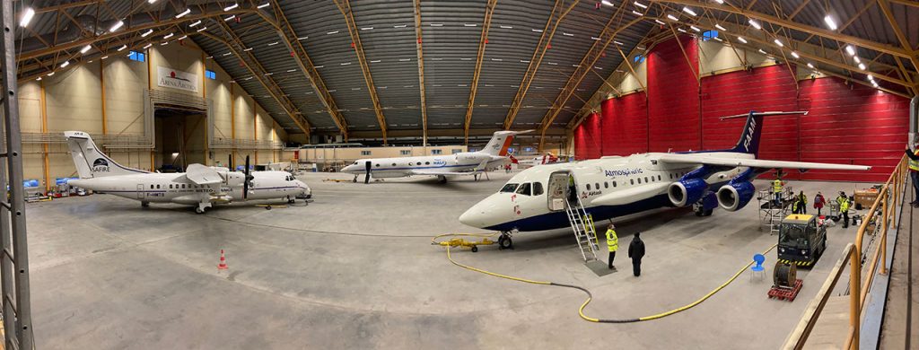
A team of scientists have taken to the skies over Scandinavia to study clouds inside the Arctic circle, marking the first overseas science campaign onboard FAAM Airborne Laboratory since the start of the Covid-19 pandemic.
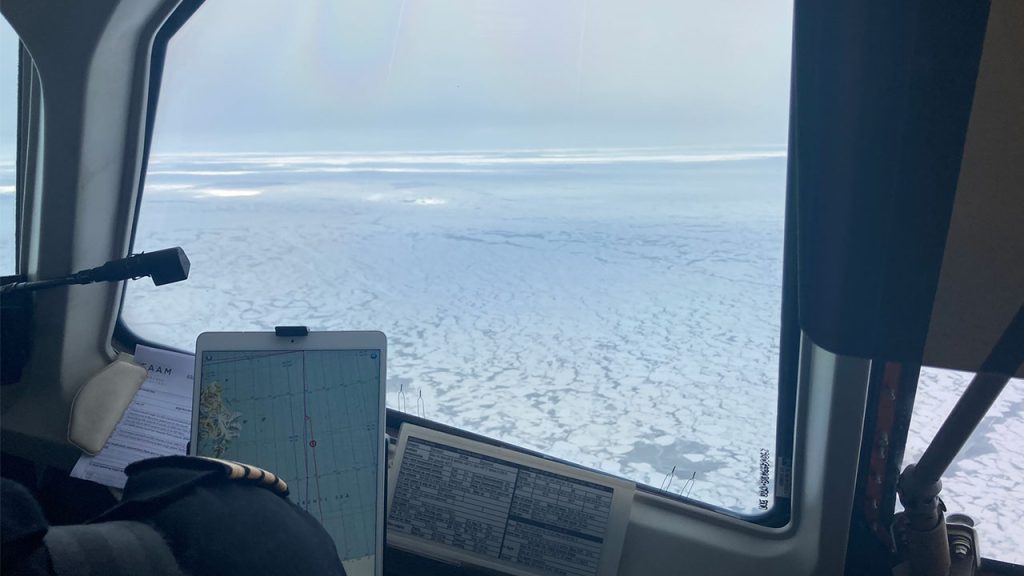
The four week aircraft campaign was set up to measure clouds as they evolve in cold-air outbreaks above Scandinavia, reaching as far North as the marginal ice-zone – the transitional area between open sea and dense drift ice.
New observations of clouds in cold-air outbreaks will allow scientists to better represent cloud processes in computer simulations, and enhance weather and climate prediction models.
Cold-air outbreaks are large-scale, long periods of severe cold weather, usually occurring in the Northern Hemisphere.
The team, which involved the National Centre for Atmospheric Science, Met Office, University of Manchester and University of Leeds, completed eighteen successful flights throughout March – at times flying alongside partner aircraft operated by Deutsches Zentrum for Lüft, Météo-France and Le Centre National de la Recherche Scientifique to coordinate their findings.
The FAAM Airborne Laboratory has been waiting for nearly two years – due to lockdown restrictions – to launch the Kiruna-based campaign, which had been planned as part of the Arctic Cold Air Outbreak project.
Despite the challenges involved, the upside is that delays have allowed the team to closely coordinate with partner research projects, such as CloudSense – who are working to study different cloud types.
The cold-air conditions over Scandinavia provide the ideal conditions for a special type of shallow cloud, known as mixed-phase clouds – clouds that contain a mixture of ice and water particles.
As part of the Kiruna flights, some researchers were specifically targeting mixed-phase clouds to find out how they might respond to a warmer atmosphere.
It is expected that climate change will alter the ratio of water and ice in these clouds, and create a feedback loop that may influence further changes in our atmosphere.
If warmer temperatures lead to more water in mixed-phase clouds, they will reflect more solar radiation, causing a cooling effect on our climate.
However, if warmer temperatures lead to more ice nucleating particles – special particles which trigger ice formation – there will be more ice in clouds, and that may cause the Earth to warm faster than expected.
The more we know about these types of processes, the more accurately we can represent mixed-phase clouds and cold-air outbreaks in forecast models which policy-makers and businesses use to inform decision-making.
For the FAAM Airborne Laboratory, the next stop is inside the hangar at Cranfield Airport, where engineers and instrument specialists will be working to install the next set of measurement tools for a campaign over the North Atlantic Ocean.