Hover to measure: Meet the drones of atmospheric science
We spoke to research scientists at the National Centre for Atmospheric Science about the use of drones – also known as UAVs – in atmospheric science. They talk about the measurements that drones can make, the range of drones available, what it is like to operate a drone in the field, and the upcoming applications of this technology.
What is a UAV?
“An Unmanned Aerial Vehicle (UAV) is also more commonly known as a “drone”. These are aircraft platforms that can either fly autonomously or are remotely piloted and they come in various types and dimensions.
“Typical types of UAV are fixed-wing and multi-rotor. A fixed-wing system is much like a regular aircraft – with two wings either side of the fuselage. A multi-rotor system tends to have four or more rotors, which are used to push air down, much like a helicopter. Typically, they can range in rotor separation or wing span between the size of a ruler and the size of a small car,” explains Dr Hugo Ricketts, research scientist at the National Centre for Atmospheric Science and University of Manchester.
Why are UAVs used in atmospheric science and what do they measure?
Within atmospheric science, UAVs are used to measure standard meteorological parameters such as temperature and humidity, but they can also be used to measure cloud particles, air pollution, and greenhouse gases. Less commonly, they can also measure atmospheric electricity or radiation.
UAVs are particularly useful for measuring parts of the atmosphere that are tricky to measure or difficult to reach with a dedicated research aircraft. This could be, for example, a few metres above the ground, in a forest canopy or above a populated area. They also offer a much cheaper alternative to light aircraft for observing the lower atmosphere.
As UAVs are significantly smaller than dedicated research aircraft, they have limitations on how much measurement instrumentation they can carry and how much power they can provide to the instruments. When deciding which type of UAV to use in atmospheric science, it’s useful to think about what and where you want to measure.
If you are wanting to cover a wide area you could use a fixed wing UAV, as this can cover a large area without using a large amount of power. If you’re interested in measuring a specific area or the atmosphere nearby, then you might use a multi-rotor system.
While these use a lot more power to stay in the air and therefore have a shorter flight duration, they offer a lot more control over measurement location and can also hover in one place. Multiple UAVs can be used to make measurements via complex flight patterns, such as grid formations or stacks.
– Dr Hugo Ricketts, research scientist at the National Centre for Atmospheric Science and University of Manchester
What UAVs do you work with?
“We are developing two new UAV platforms that will be used to measure standard meteorological parameters such as temperature, humidity and pressure, as well as cloud particles,” says Dr Hugo Ricketts, research scientist at the National Centre for Atmospheric Science and University of Manchester.
“We are testing instrumentation to deploy on UAVs to measure atmospheric greenhouse gases in situ as part of the UK’s Greenhouse Gas Emissions Measurement and Modelling Advancement programme.
“A major component of this work is to assess how well the analysers perform when in the air, by making measurements using UAVs close to well-established high-precision observations.
“We’re using heavy payload UAVs along with state-of-the-art analysers, with deployable units typically weighing more than 10 kg and costing several thousand pounds,” adds Dr Grant Forster, research scientist at the National Centre for Atmospheric Science and University of East Anglia.
What makes the data usable by others?
Measurements made by instruments mounted on UAVs will be made for a specific scientific purpose or project, but may also have other uses – for example to compare with a ground-based measurement, or as a reference point to input into a climate model.
Through effective data management we can maximise the potential usage of any measurements. We do this by making the data Findable, Accessible, Interoperable and Reusable (or FAIR).
– Dr Wendy Garland, senior environmental data scientist at the Centre for Environmental Data Analysis, National Centre for Atmospheric Science, and STFC Rutherford Appleton Laboratory
“We make the data discoverable and available through online archives, and store it in community-agreed standard data formats so that existing tools can be used to analyse and visualise the data.
“We also make sure that sufficient information is recorded to fully describe the initial purpose, the instruments and UAV platforms, together with details of UAV orientation and flightpath. By fully documenting and publishing the data, potential users are provided with full context to reuse it with confidence, and the original authors can receive due credit for their work,” explains Dr Wendy Garland, senior environmental data scientist at the Centre for Environmental Data Analysis, National Centre for Atmospheric Science, and STFC Rutherford Appleton Laboratory.
Why did you start using drones?
“My use of UAVs began in 2014 whilst initially using them for aerial photography. Fairly quickly I realised the capability of these machines to carry all kinds of atmospheric sensors into areas difficult to reach by any other means. Furthermore, programmable/automated drones can repeat the same flight pattern with high precision, a useful skill for scientific applications,” shares Dr Ben Pickering, research scientist at the National Centre for Atmospheric Science and University of Manchester.
“My background is in high-precision measurements of atmospheric trace gases from various measurement platforms across the world. I currently coordinate the long-term measurements of greenhouse gases and tracer species at the Weybourne Atmospheric Observatory on the North Norfolk coast. I love the challenge of working with the available technology, like UAVs, and figuring out how this can benefit our understanding of the atmosphere,” adds Dr Grant Forster, research scientist at the National Centre for Atmospheric Science and University of East Anglia.
What’s it like to operate a UAV?
“Operating a UAV can be challenging and daunting at times, and it’s essential that it is done right! Particularly for the deployment of the heavier payload drones, it is of paramount importance that our operations are conducted safely and within the rules laid out by the governing bodies; this requires extensive training and certification,” explains Dr Grant Forster, research scientist at the National Centre for Atmospheric Science and University of East Anglia
There is always a mix of excitement and nerves when you try something new, be it a new aircraft, new payload lifting off the ground for the first time. You spend a lot of time planning these flights to ensure safety, but when it all comes together and you capture data never seen before—the feeling is indescribable.
– Dr Ben Pickering, research scientist at the National Centre for Atmospheric Science and University of Manchester
What do you look forward to in your work with UAVs?
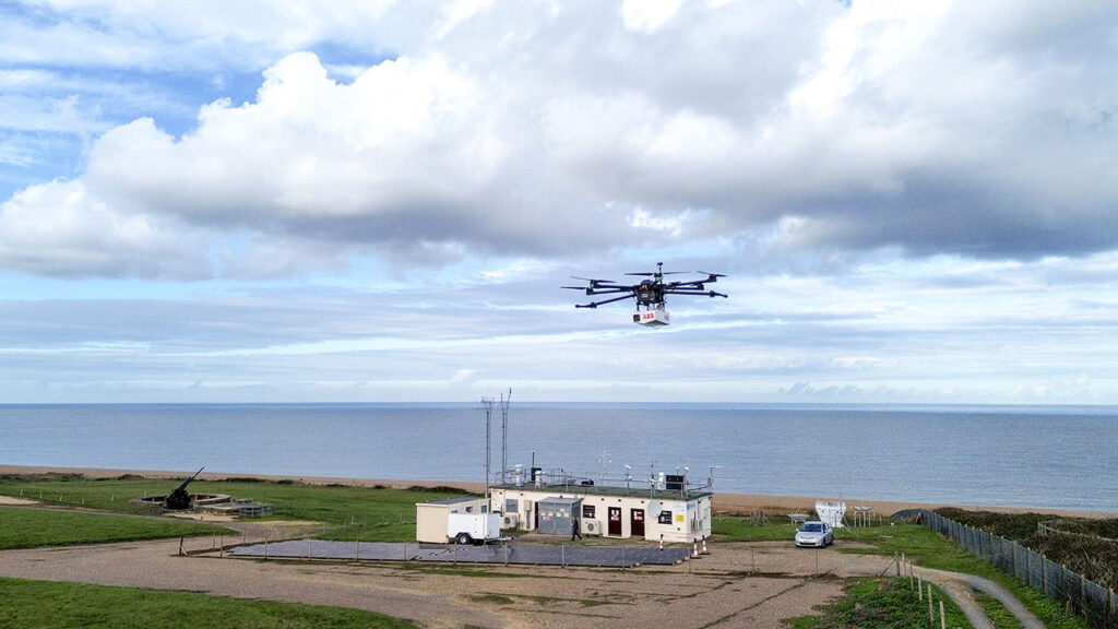
“I’m looking forward to deploying drones at the Weybourne Atmospheric Observatory. UAV deployable greenhouse gas analysers will be flown alongside high-precision atmospheric measurements of greenhouse gases to assess the precision and accuracy of in situ UAV measurements,” says Dr Grant Forster, research scientist at the National Centre for Atmospheric Science and University of East Anglia.
“I look forward to a future where drone-based measurements happen many times a day for the benefit of weather forecasting. What was for a long time considered ‘impossible’ could become ‘routine’, and that potential excites me greatly.
“I don’t think flying UAVs will ever get old for me; it’s definitely a thrill to be in the pilot’s seat (so to speak). The technology is advancing very rapidly and there’s always more capable aircraft, new advanced payloads, and therefore new atmospheric phenomena we are able to study,” shares Dr Ben Pickering, research scientist at the National Centre for Atmospheric Science and University of Manchester.
What do you think is the future of UAVs in atmospheric science?
“I think UAVs will be an important tool for atmospheric scientists in the future to bridge the gap between what can be measured from the ground and what can be measured from atmospheric research aircraft.
“With the right planning and applications, UAVs could provide an economic alternative to flying atmospheric research aircraft close to the ground. But, UAV deployable instrumentation needs to come a long way before the maximum benefit can be realised for many areas of atmospheric science,” answers Dr Grant Forster, research scientist at the National Centre for Atmospheric Science and University of East Anglia.