Weather disruptors: What are named storms and how do they affect the UK
We spoke to storm scientists at the National Centre for Atmospheric Science. They explain why storms are named, what causes extreme storms in the UK, and if storms will become more intense and frequent.
Why are storms named?
In the UK, a storm is given a name when it has the potential to cause disruption or damage as a result of strong winds, heavy rainfall or snow, leading to amber or red weather warnings being issued.
The UK storm season begins at the end of the summer in September and ends in August the following year.
In Europe there are three storm naming groups, and each September there is a new alphabetical list of names issued for the upcoming storm season. In Western Europe the list is created by the Met Office in collaboration with the Irish and Dutch weather services. This coincides with when we expect to experience extreme storms, due to low pressure weather systems that occur in the autumn and winter months.
Storms can impact many countries at once, and to avoid confusion, the UK adopts a storm name if another European weather service has already named it.
Since the current naming scheme started in 2015, between 0 – 9 named storms hit the UK by the end of each winter.
What causes extreme storms in the UK?
Wind is the movement of air in our atmosphere. Air is forced to move by differences in atmospheric pressure, and the Earth’s rotation means that the wind circulates around areas of lower pressure, known as a cyclone. A greater difference in pressure causes stronger winds.
Storms often bring heavy rainfall that may lead to flooding. Storms move moisture around the atmosphere, which forces warm and moist air to rise. Wherever the warm, moist air rises, clouds are formed. The formation of clouds also releases energy which can further intensify the storm.
The UK is renowned for being stormy, but why? The jet stream – a core of strong winds around 8-11 km above the Earth’s surface, blowing from west to east – directs weather systems, such as storms, across the Atlantic to the UK.
Numerous factors influence the position of the jet stream, for example a strong El Niño event can influence a season’s storms. El Niño typically results in a stormier autumn and early winter, but a less stormy late winter.
Dr Ben Harvey, Senior Research Scientist, at the National Centre for Atmospheric Science and University of Reading
Will extreme storms become more intense and frequent?
Chance can always play a role since UK weather can vary a lot from year to year. Storms tend to vary naturally in intensity and frequency on an annual basis – this makes identifying trends in storms particularly challenging.
However, links between human-caused global warming and storms should be expected. A warming atmosphere is linked with heavier rainfall, because the air is able to hold more moisture – and leads to clouds containing a greater number of larger raindrops.
As the climate continues to warm, the effect will increase, and storms with heavy rain are expected to become more common. Additionally, the extra release of energy by clouds will likely lead to an increased rate of storms that rapidly intensify and a strengthening of the most extreme storms. But while a warmer world is likely making the most extreme storms more intense, the change in the overall number of storms is more uncertain and remains a subject of ongoing scientific research.
Research suggests that currently a third of all storms with strong surface winds, and nearly half by the end of the century, in the North Atlantic region may be accompanied by powerful sting jets as a result of global warming.
Sting jets are narrow jets of air that accelerate as they descend and that can cause extremely strong and damaging surface winds in a relatively small area of the storm. They are called sting jets as they descend from the tip of the hooked cloud that gradually wraps around the area of low pressure at the centre of the storm. The presence of a sting jet can make intense storms, with strong surface winds, even more damaging.
Dr Ambrogio Volonté, Senior Research Fellow, at the National Centre for Atmospheric Science and University of Reading
Damaging winds in winter storms are not limited to sting jets as they can be caused by a number of different airstreams, and storms can still be extremely damaging even without the presence of a sting jet. For instance, in February 2022’s Storm Eunice – one of the most damaging storms to hit the UK in recent years – the damaging winds were associated with a sting jet and with several other airstreams.
Dr Emily Grace Norton is a meteorological instrument scientist at the National Centre for Atmospheric Science and University of Manchester, who uses radar wind profilers to measure the structure of the storms as they pass over the UK. The wind data Dr Norton collects is used by European Meteorological weather services to improve weather forecasts.
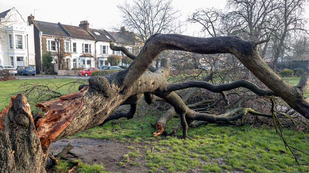
Extreme storms can cause extensive and expensive damage to homes and infrastructure, cause widespread disruption to travel, and can be a risk to life. It’s important that we improve scientific understanding of the effects of a warming climate on extreme storms, so that society can mitigate the impacts.
Dr Emily Grace Norton, Meteorological Instrument Scientist, at the National Centre for Atmospheric Science and University of Manchester
