Scientists capture small weather-sensing drone flight up to 2km
Watch a small weather-sensing drone fly through clouds to measure atmospheric processes over southern England.
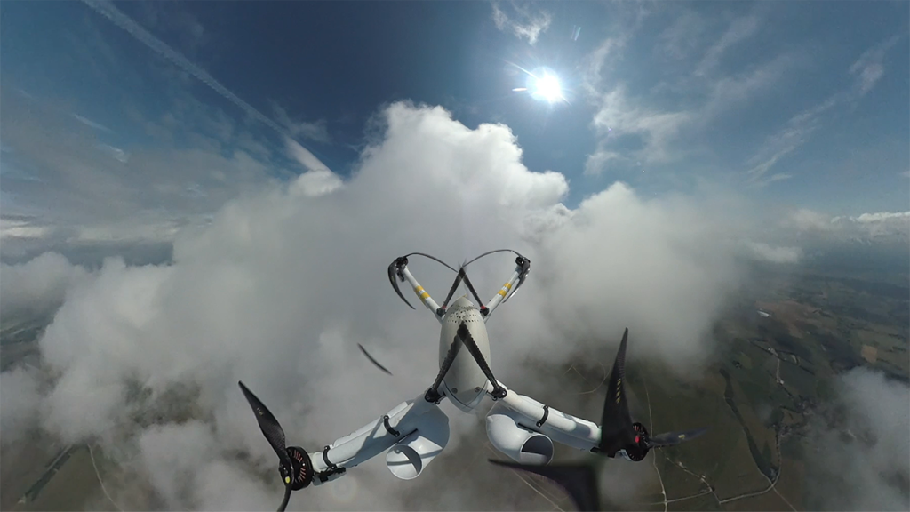
Researchers captured the 360º video footage at 1.5km, as part of a summertime weather measurement campaign.
The video was taken onboard a MetSprite uncrewed aircraft system conducting its first beyond visual line of sight meteorological profile up through the boundary layer – the layer of the atmosphere closest to the Earth’s surface.
The drone is fully automated, harsh-weather resistant and fitted with integrated meteorological sensors.
To date, the drone has been able to make pressure, temperature, humidity, and 3D wind turbulence observations with unprecedented accuracy and resolution up to 2km above ground.
A team of researchers led by the National Centre for Atmospheric Science, the University of Leeds, and the Met Office are conducting a novel observational campaign in the south of England, to improve forecasts of extreme weather like thunderstorms.
The campaign, combining science projects called WesCon and WOEST, focuses on observing turbulent processes in our atmosphere and enhancing weather forecaster’s ability to make high resolution predictions.
The novel observations, collected by drone flights as well as by radar and research aircraft, will lead to improved weather forecasts of storms – when they are likely to start and how much rain will fall.
Dr Ben Pickering, Chief Meteorological Officer of Menapia, operates the weather-sensing drones and explains:
“We’re pushing into new territory by making beyond visual line of sight measurements at 2 km, and intend to push to even higher altitudes as our confidence and our airspace permissions allow.”
“At the moment, weather forecasting models rely on theoretical knowledge to simulate turbulence and storms in our atmosphere, and this could be a large source of potential errors in weather predictions.
“The data collected from these platforms could revolutionise the way we understand and predict thunderstorms in the UK. Long-term we envision routine, automated drone observations to be ingested every day by weather forecast models.”
Dr Ryan R Neely III, lead scientist of the WOEST project, adds:
“This is a first for the UK. We are now able to repeatedly profile the full extent of the boundary layer with high resolution sensors. Not only is this important for our current project but it is also a big technological step forward for our entire field.”