See inside the clouds: Meet our atmospheric radars
Have you ever wondered how scientists track storms before they hit, or how they gather data from the highest layers of the atmosphere?
One of the instruments that can be deployed to get these answers is the radar – a vital tool in atmospheric science.
What is an atmospheric radar?
Atmospheric radars are used to measure cloud properties, precipitation, and winds. Radar observations are essential in studying climate and extreme weather events, and have a wide range of uses that extend beyond atmospheric science. A radar essentially allows scientists to see what’s happening inside clouds from the ground.
Did you know? The word radar is an acronym for radio detection and ranging, and weather radars have been used since the 1940s.
So, how does it work? A radar transmits pulses of electromagnetic radiation, and measures the amount of signal scattered back to the receiver by targets in the atmosphere. Radars operate within different frequency bands, where each band is suitable for detecting targets of a certain size. These targets can be meteorological (rain, snow, hail, or clear air returns), non-meteorological (buildings, trees or the ground surface), or even biological (birds and insects). The returned signal provides information on the location and intensity of the targets, and is visualised with specialist software.
The microwaves are generated by a magnetron, the same device as found in your microwave oven! An antenna is used to focus the microwaves into a narrow beam. The size of the antenna determines the size of the beam, which in turn determines the resolution of the data.
– Dr Lindsay Bennett, Radar Operations, Data and Partnerships Lead at the National Centre for Atmospheric Science and University of Leeds
Our atmospheric radars
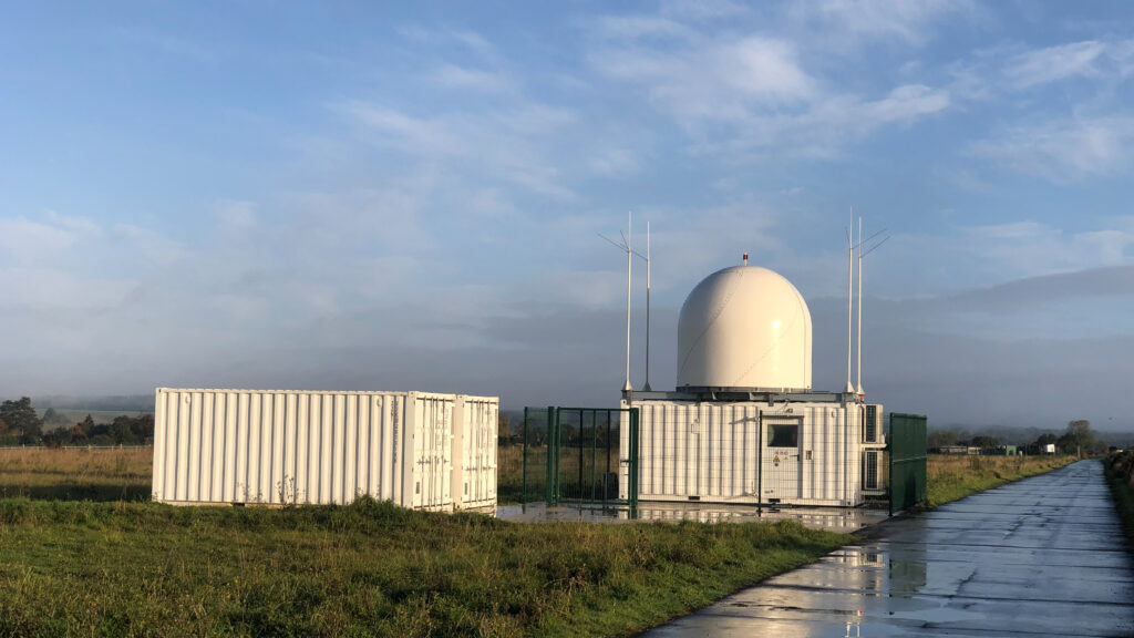
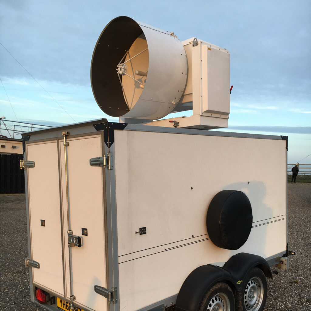
The first mobile weather radar at the National Centre for Atmospheric Science (NCAS) was an X-band system mounted on a towable trailer, allowing it to be transported around the UK and abroad to study clouds and rainfall.
With its arrival in early 2012, NCAS also welcomed Dr Lindsay Bennett as Radar Instrument Scientist. “We used NXPol1 to study the initiation of clouds (when and where clouds form), how they develop from small cumulus clouds into large thunderstorms, and how much precipitation falls. It was used in a number of field campaigns in the UK and one in Cape Verde to improve our understanding of these processes. As NXPol1 approached the end of its lifespan, a capital investment provided the opportunity to design a new system to replace it. Building on our experience from the previous twelve years, we designed a more robust system where the radar is installed on top of a shipping container and accessed via a hatch from inside. We’ve created a solution which can be accessed, operated and maintained in any weather,” says Lindsay.
Provided by the NCAS Atmospheric Measurement and Observation Facility (AMOF), scientists have access to cloud radars and weather radars. The Ka-band mobile cloud radar (known as Kepler) can observe much smaller particles, so it can see the earlier stages of cloud formation. This radar is used to measure clouds, fog, and wind. Meanwhile, the NXPol2 weather radar sees larger particles, and measures precipitation, winds, and even insects!
“The names of these bands originated during World War II. The letters were a secret code so scientists and engineers could talk about frequency ranges without disclosing them. C, S and X-band are used for weather radars that detect larger precipitation particles such as rain and hail. W and Ka-band are used for cloud radars that can detect much smaller droplets and ice particles during the early stages of cloud formation,” Lindsay explains.
Scientists at NCAS also have access to the AMOF Chilbolton Atmospheric Observatory which hosts the largest fully steerable meteorological radar in the world, the Chilbolton Advanced Meteorological Radar (CAMRa). Its large 25m antenna creates a very narrow beamwidth enabling it to observe details of clouds in high resolution.
So what’s it like to work with a radar?
Deploying and operating the radars requires a team of people with specialist skills from various fields, including meteorology, atmospheric physics, and engineering.
The research scientists specialise in operating the radars and interpreting the data to understand weather patterns, atmospheric dynamics, and cloud microphysics. They monitor the data in real-time, ensuring the radar is performing correctly and interpret the data to provide insights into ongoing weather systems. They collaborate with other researchers to improve our understanding of cloud processes and how these processes are represented by forecasting models.
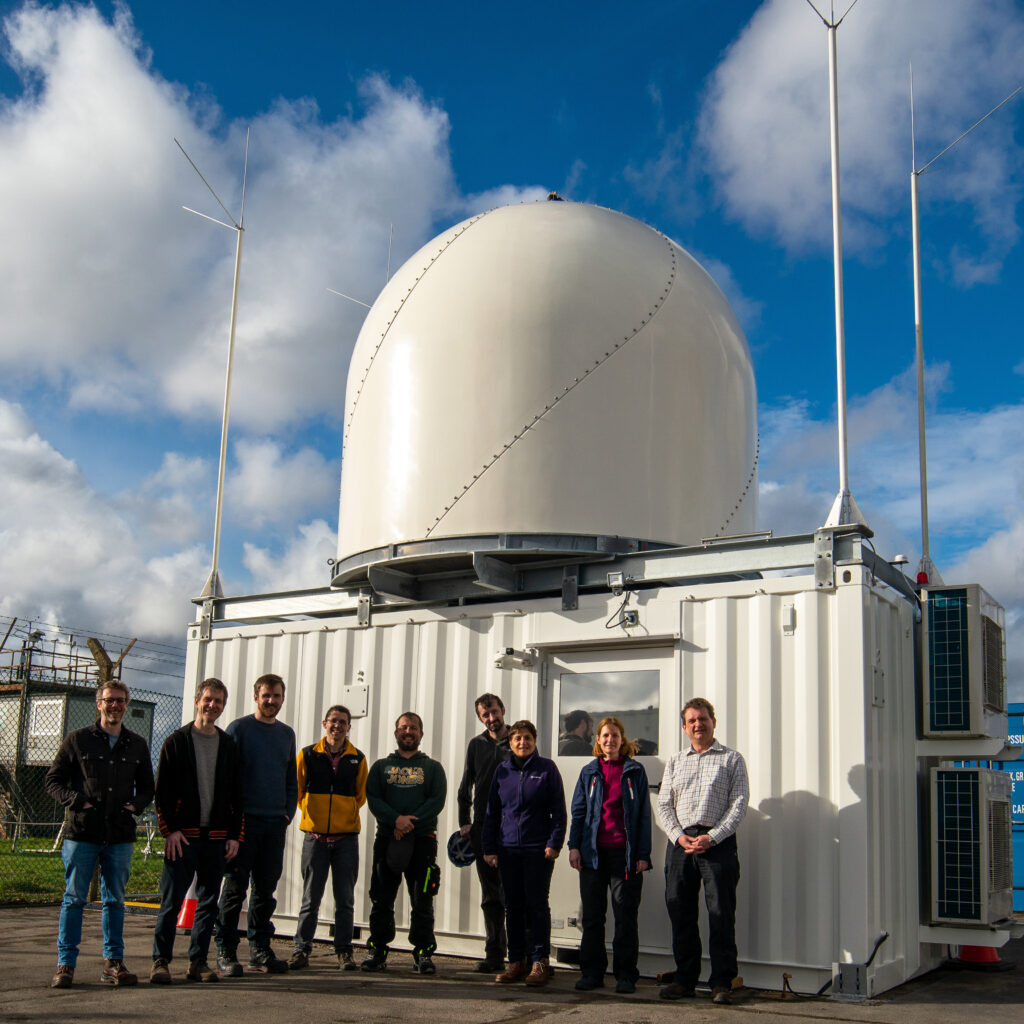
We spoke to three researchers and one engineer who work with radars at NCAS.
After an undergraduate degree in Meteorology I came to Leeds to study for a PhD focussing on the analysis of observations of the boundary layer, the lowest part of the atmosphere, to better understand the mechanisms that trigger showers and thunderstorms: how, why and when do clouds form. The observations I helped collect during the Convective Storm Initiation Project (CSIP) in 2005 were crucial for scientists testing and validating the performance of the Met Office weather forecasting model at the time, and gave them confidence to upgrade to a newer higher resolution version.
During my time at NCAS I have deployed the NXPol1 radar on five different projects, focusing on the detailed processes that occur within clouds and high resolution measurements of rainfall near the surface to help improve forecasts of flooding.
– Dr Lindsay Bennett, Radar Operations, Data and Partnerships Lead
I am an atmospheric physicist at heart who likes to explore the world. I enjoy taking advantage of the interaction of radio waves and matter (be that clouds, precipitation or animals) to reveal things about the atmosphere that cannot normally be seen. I have a BA in Physics, and a Masters and PhD in Atmospheric and Oceanic Science. I have been from the South Pole to the top of the Greenland Ice Sheet and sent one of the NCAS radars to the North Pole with our colleagues.
– Dr Ryan Neely, Principal Investigator
My research focuses on the processing of weather surveillance radar data, particularly to obtain accurate estimates of precipitation at the surface.
– Dr David Dufton, Research Fellow
I oversee the maintenance, calibration, and logistics of the NCAS radars, coordinating deployments and ensuring they operate correctly to maintain data quality.
– Alex Fearn, Radar Support Engineer
From exploring the world, to getting stuck in untangling data, there is a lot to get excited about this field of science. Neely shares what he enjoys most about his job:
I love going to new places and seeing things that no one else has. It is a privilege to be able to travel to the places we take the radars. Along the way, I have gotten to meet and work with some fantastic people that all deeply care about helping to make the world a better place.
David adds:
I love the complexity of weather radar observations and the challenge of disentangling real atmospheric signals from artefacts in the data.
I’m currently working on data from a field campaign in New Mexico, DCMex (Deep Convective Microphysics Experiment) and enjoying the challenge of developing analysis methods that allow the comparison of detailed radar observations with cloud model simulations. These comparisons will help improve our understanding of the microphysical properties, the size, shape, habit and phase of the particles making up convective anvils which can have a significant impact on the climate.
Meanwhile, Lindsay reminisces about some of her greatest achievements and memories:
I’m really proud of my role in the design and procurement of NXPol2. It was hard work towing NXPol1 around the UK! Mobile radars are much more suited to chasing tornadoes in the USA. I am happy that we now have a system that is easier to transport, more robust to severe weather and much easier to maintain thanks to the trap door inside the container.
NXPol2 was installed just in time to take part in the WOEST project during summer 2023, a large UK field campaign aiming to measure the fine-scale turbulent processes in clouds. It was also the last project for NXPol1 before retirement, and the combined measurements from both radars have been really crucial for scientists to derive 3D wind fields.
And what’s on the horizon? Alex is getting ready to go to Italy this summer, to contribute to the TEAMx project:
We’re getting ready to deploy the NXPol2 radar in northern Italy, alongside an international team of researchers and instruments. This will be a demanding deployment, with the radar installed at 2,500m on a mountain summit.
…while Neely has his eyes set on somewhere colder:
Studying bird migration in Antarctica is high on my list. Migratory seabirds travel from as far away as the other pole to nest in mountains that encircle Antarctica. NXPol2 has the capability of illuminating how many birds there are in certain regions and what patterns their behaviour follow.
I also want to push our ability to observe and understand storms over the Greenland ice sheet. Understanding the influx of mass from precipitation (snow) is key to understanding the processes that lead to sea level rise.
But Lindsay is looking to focus on improving the accessibility in atmospheric science:
I’ll be focussing on making our data more accessible to the research community and widening the group of users, within atmospheric science but also from other fields. Radar data can be quite daunting and difficult to use, so we will be developing tools and resources to provide scientists with the knowledge and expertise needed to use the data in their analysis.
And what does the future of radars look like?
With technology always evolving, we can expect that radars will continue to offer more research opportunities. Advancements in machine learning will also make it easier to look at the large amounts of data the radars collect.
As Neely says, “The future of radars is exciting. There are new technologies that will allow us to scan faster so we can see more turbulent processes. There are also technologies emerging that will allow us to see in more “colours” (i.e. other bands). Both will help us penetrate the hearts of clouds better.”