How researchers are observing rainfall in flood-risk regions
Over the last five years, a team of researchers from the National Centre for Atmospheric Science have been working to improve rainfall observations in flood-prone areas across England and Scotland.
They specialise in deploying a mobile weather radar, capable of operating in hard-to-reach areas of the Met Office’s fixed weather radar network. Weather radars are routinely used to monitor rainfall patterns, because they provide near-real time updates on how much rain is falling at different locations, at different times.
These observations also provide the input for hydrological computer models, which generate flood forecasts from past and present rainfall data. But, in some areas, the coverage and quality of radar observations is limited. Radar beams increase in height as they travel further away – meaning they can overshoot storm clouds – or be blocked entirely by mountains.
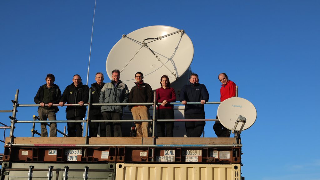
In these places, researchers have been deploying a mobile weather radar – small enough to be transported on a vehicle trailer – to make rainfall observations that might otherwise get missed. The radar can be moved around to areas it is most needed, where it can send radar beams at low elevations to observe ground-level rainfall.
The expert team, led by the National Centre for Atmospheric Science (NCAS) and University of Leeds, are helping environmental protection authorities to make more accurate and reliable flood forecasts, and are providing recommendations to future proof our weather radar network.
One of their recent measurement programmes – Radar Applications in Northern Scotland – has now published its analysis in the Journal of Hydrometeorology.
Their study showed that having a closer radar is the best, and perhaps only way, to improve widespread rainfall observations in the challenging Inverness region of Scotland. There are few places more challenging for collecting accurate rainfall estimates than Northern Scotland, where the group deployed the mobile radar in partnership with the Scottish Environment Protection Agency.
The radar, operated by NCAS’ Atmospheric Measurement and Observation Facility, was deployed in Kinloss for six months, between February and August 2016. Inverness sits thirty minutes north of the Cairngorms National Park, home to some of the UK’s highest mountains. In this region, the weather conditions are unpredictable, with avalanches in winter and flash floods in summer.
And, although Scotland receives roughly 1.5 metres of rainfall every year, that figure can vary wildly depending on where you look, with some areas much wetter than others. The variations depend mostly on the features of the region, such as nearby mountains, valleys or lakes, and in areas of high elevation, sleet and snow are more common.
These topographical features play a significant role in rainfall patterns, but at the same time, can be a challenge for researchers when collecting rainfall information through radar observations. In these locations, the mobile weather radar offers a way for NCAS to provide targeted and high quality observations that inform risk management for flood-prone regions.
We found that precipitation estimates from our mobile radar outperformed the existing fixed radar network when used as the input for hydrological models within the Inverness area. With our input, the computer model was a closer match with reality. The mobile radar also more accurately matches the rain-gauges – funnels that collect and measure rain in situ – across the region, compared to the nearest network radar.
Dr David Dufton, a Research Fellow in Radar Hydrometeorology at the National Centre for Atmospheric Science and University of Leeds
The mobile weather radar is also known as the mobile dual-polarisation Doppler X-band weather radar. It is operated by scientists Dr Lindsay Bennett and Dr Ryan Neely at the Atmospheric Measurement and Observation Facility, which is part of the National Centre for Atmospheric Science and funded by the Natural Environment Research Council. The National Centre for Atmospheric Science works with the Met Office, Scottish Environment Protection Agency, The Environment Agency, and in collaboration with the UK Centre for Ecology & Hydrology.
