Meet the instrument helping to improve weather forecasts for UK cities
The National Centre for Atmospheric Science has recently deployed a doppler lidar in Bristol.
Dr Phil Rosenberg is an instrument scientist at the National Centre for Atmospheric Science based at the University of Leeds. We asked Phil about the scientific instrument and how it is being used to help improve weather forecasts for UK cities.
What is a doppler lidar?
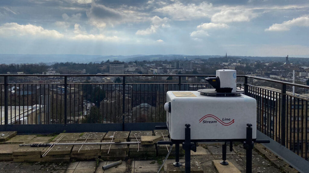
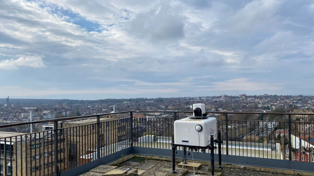
“A doppler lidar is a scientific instrument, about the size of a washing machine, which uses a laser to probe the atmosphere around it. In particular it measures winds and gives a rough idea about the amount of pollution in the air.”
How does a doppler lidar work?
“A doppler lidar uses a high power laser, which it emits as a beam. As the laser beam travels away from the lidar, some of the light bounces off tiny particles of pollution in the air and returns to the lidar – this is the same effect that means you can see the beam of a laser pointer or a torch if you are in a dusty or misty environment. The “doppler” part of the lidar indicates that the lidar specifically measures tiny shifts in the wavelength of the light that bounces back. If the pollution particles are being blown away from the lidar, the wavelength is increased and if they are being blown towards the lidar the wavelength is reduced.”
Why are doppler lidar used in atmospheric research?
“We use doppler lidar anywhere where we want to understand how the wind works or how it affects other weather phenomena, such as rain cloud formation. They are a great tool because their lasers can be pointed in different directions and they can probe different ranges in order to build up information about the wind over a large volume of the atmosphere.”
Why do we care about wind?
“Here we are not concerned about the damaging winds that would blow your roof off – although those are of course important – but we are instead thinking about how winds clear pollution out of a city or how cities slow the wind down, perhaps affecting the track and intensity of shower clouds that blow in from the sea. We want to know how winds get funnelled down streets and around buildings, and how cities can slow down a cooling breeze, exacerbating a heatwave. This is very much about the building blocks of our next generation of high resolution weather forecasting simulations, rather than trying to capture rare and extreme events.”
What is the project called, who is involved, and what is NCAS’s role?
“The project is called ASSURE, which stands for Across-Scale processeS in URban Environments. It is being led by the University of Reading and NCAS are providing one of five lidar via NCAS’s Atmospheric Measurement and Observation Facility. We are data providers for this project – we are providing an instrument and ensuring the data quality from that instrument over the course of the project.”
Why has the project started now, and how long will it go on for?
“On larger timescales, this study is now important because our weather forecasting simulations are reaching high enough resolution that they can start to “see” detail within a city. A few years ago a typical weather simulation would have a resolution of 2-20km, so a city like Bristol might only constitute 1 pixel. Now simulations can have resolutions of around 100m. This provides an opportunity to provide more detailed information, but also means it is much more important that we understand how the urban environment affects our weather. To do this we have deployed the lidar instruments for a full year, which will help us capture the effects throughout all the seasons.”
Why are five doppler lidar being deployed together?
“By using five instruments we can set them up across and around the city of Bristol. We can place one to the south west, where most of the wind comes from, one to the north east, where most of the wind blows to, and the others around the city. In this way we can see how the wind blows over and around buildings. And we can detect the urban heat island effect, when the air is warmed by tarmac and concrete surfaces absorbing the heat of the sun.”
What was involved in deploying the NCAS doppler lidar?
“The NCAS doppler lidar was placed on the roof of the Physics building at the University of Bristol. The biggest challenge was the set of stairs leading from the top floor onto the roof. The lidar usually needs two people to lift it, but that is if it is on flat ground. So instead, we used a motorised lifter to get it up the stairs. This lidar is very robust – it has been on ships moving through Arctic ice sheets – so there were no concerns that the lifting would cause any problems.”
Why is the study taking place in Bristol?
“Bristol is about the right size of city for a project like this. It is big enough to have an impact upon the wind, but small enough that our instruments can give us a good overview. It also has a clear prevailing wind direction from the south west and a wide range of building sizes and variations in height, including its famous Avon Gorge with the Clifton Suspension Bridge.”
Is the project looking at other areas in the UK?
“This project is just focused on Bristol, and is looking at the winds before, during and after they pass over the city. The intention is to take what we learn from the Bristol study, and use that to improve our predictions for other cities in the UK.”
How will you collect and analyse the data?
“The data is initially stored on a computer within the lidar, but then transmitted to the University of Reading over the mobile phone network. NCAS put the data into a more user-friendly data format and it will eventually be archived at the Centre for Environmental Data Analysis, where it will be available for scientists to use. The data from our lidar will be combined with that from the other instruments, to build a picture of how the wind changes as it blows over Bristol. Of particular importance is the drag generated by the city, which slows the wind down, and also the heating that causes the air to rise and potentially lead to the creation of rain clouds.”
What is the initial data showing about the winds in southwest England?
“We are still in the very early stages of the study. At the moment, we are trying out a range of scan patterns and scheduling the lidars to point their lasers in different directions. We are still awaiting two more lidar, arriving from mainland Europe, so this period gives us some time to determine the best observing strategy before the project fully begins.”